Free Browser-Based Image Geotagging: Add Location Data to Your Photos

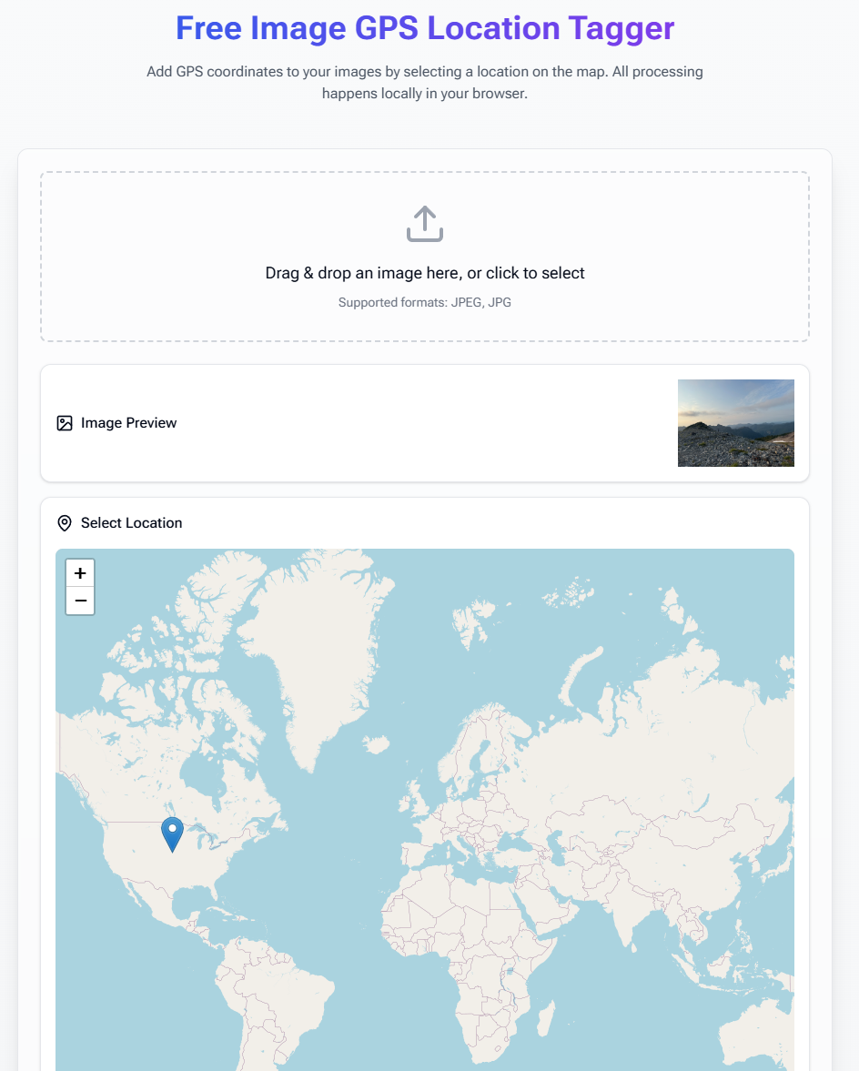
Want to add location information to your photos? Our free geotagging tool at Warpbin allows you to easily add GPS coordinates to your images right in your browser, with complete privacy and security.
What is Geotagging?
Geotagging is the process of adding geographical identification metadata to photos, including:
- Latitude coordinates
- Longitude coordinates
- Altitude information
- Location name
- Map data
Why Geotag Your Photos?
📍 Location Documentation
- Track photo locations
- Create travel memories
- Document exploration
- Map photography spots
- Build location histories
🗺️ Organization Benefits
- Organize by location
- Create photo maps
- Sort by geography
- Build travel journals
- Enhanced searching
📸 Professional Uses
- Real estate photography
- Nature documentation
- Location scouting
- Event coverage
- Archaeological records
How to Geotag Your Images
- Visit Warpbin's Geotagging Tool
- Upload your image(s)
- Select location on the map or enter coordinates
- Add additional location details
- Download your geotagged images
Key Features
🔒 Privacy First
- Browser-based processing
- No server uploads
- Complete data privacy
- Secure handling
- Local operations
🌍 Location Tools
- Interactive map selection
- Coordinate input
- Location search
- Altitude data
- Location names
📱 Device Compatibility
- Works on all devices
- Mobile friendly
- Tablet compatible
- Desktop optimized
- Cross-platform support
Professional Applications
1. Real Estate Photography
- Document property locations
- Map listing photos
- Create location portfolios
- Track site visits
- Organize property shots
2. Travel Photography
- Create travel logs
- Map photo journeys
- Document destinations
- Build location collections
- Track adventure spots
3. Nature Photography
- Document wildlife locations
- Map hiking trails
- Track seasonal changes
- Record plant locations
- Monitor environments
Best Practices
1. Accuracy Matters
- Verify coordinates
- Double-check locations
- Use precise positioning
- Consider altitude
- Review before saving
2. Privacy Considerations
- Consider sensitivity
- Remove when sharing
- Control access
- Protect private locations
- Manage location data
3. Organization Tips
- Use consistent naming
- Create location groups
- Maintain backups
- Document changes
- Tag systematically
Technical Details
Supported Formats
- JPEG/JPG images
- PNG files
- TIFF support
- Original quality maintained
- No compression
Location Data Types
- GPS coordinates
- Altitude information
- Location names
- Map references
- Directional data
Common Use Cases
- Travel Documentation
- Track journey points
- Map destinations
- Document stops
- Create travel guides
- Share locations
- Professional Photography
- Location scouting
- Site documentation
- Client locations
- Project mapping
- Portfolio organization
- Research & Documentation
- Field research
- Site surveys
- Location studies
- Geographic documentation
- Environmental monitoring
Frequently Asked Questions
How accurate is the geotagging?
Our tool uses precise GPS coordinates and map data to ensure accurate location tagging.
Can I geotag multiple images at once?
Yes! You can batch process multiple images with the same location data.
Will geotagging affect image quality?
No, our tool only adds location metadata without affecting the image quality.
Can I remove geotags later?
Yes, you can use our metadata editor to remove location data if needed.
Is it safe to use this tool?
Absolutely! All processing happens in your browser - your images never leave your device.
Privacy and Security
Our commitment to your data:
- No server uploads
- Local processing only
- Private operation
- Secure handling
- Complete control
When to Use Geotagging
Consider geotagging when:
- Documenting travel
- Creating location portfolios
- Mapping photo projects
- Building location databases
- Organizing by geography
Ready to Start Geotagging?
Visit our Free Image Geotagging Tool now and add location data to your images with confidence. No registration required, no data uploads, just simple and effective geotagging when you need it.


